Context:
Sentinel-6B Satellite was recently launched from the Vandenberg Space Force Base in California, U.S.
About Sentinel-6B:
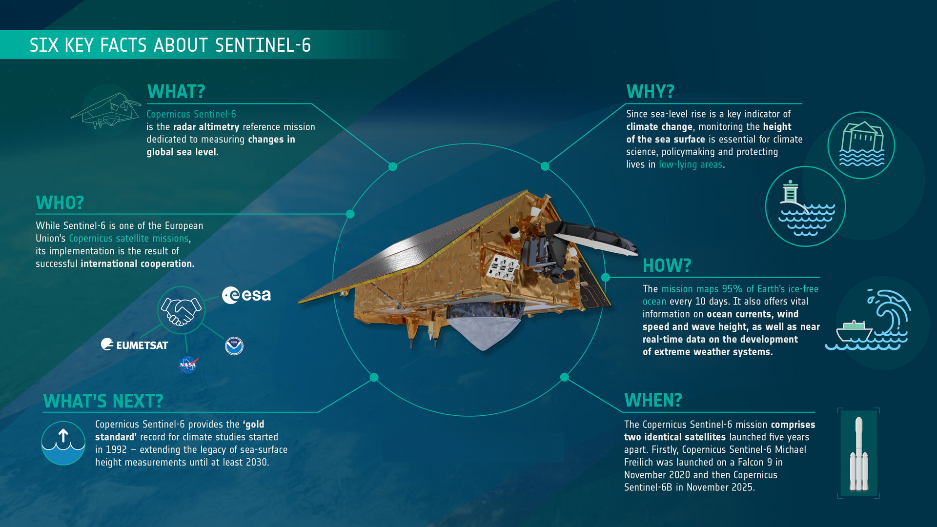
Sentinel‑6B is an Earth observation satellite launched to monitor global sea levels. Developed under the Copernicus Sentinel‑6 / Jason‑CS mission, it is a joint undertaking by ESA (European Space Agency), NASA, NOAA, EUMETSAT, and CNES.
· It was launched aboard a SpaceX Falcon 9 rocket from Vandenberg Space Force Base, California
Key Objectives & Instruments:
-
- Sentinel‑6B’s primary goal is to provide precise sea surface height measurements, enabling scientists to monitor sea-level rise, ocean circulation, and climate change impacts.
- It carries a Poseidon-4 radar altimeter that measures the round-trip time of radar pulses reflected from the ocean, with centimeter-level accuracy.
- It also has an Advanced Microwave Radiometer (AMR‑C) to correct for atmospheric water vapor, and a GNSS Radio Occultation (GNSS‑RO) instrument to derive vertical atmospheric profiles of temperature and humidity.
- Sentinel‑6B’s primary goal is to provide precise sea surface height measurements, enabling scientists to monitor sea-level rise, ocean circulation, and climate change impacts.
Strategic Importance & Applications
-
- The data from Sentinel‑6B is vital for climate science, forecasting extreme weather, and coastal planning.
- By extending a long-term record that began with the first Jason missions in 1992, Sentinel‑6B helps in understanding sea-level trends, ocean currents, and the impacts of rising oceans on vulnerable coastal communities.
- Furthermore, its atmospheric data supports improved weather models, including those used for safe re-entry planning of spacecraft.
- The data from Sentinel‑6B is vital for climate science, forecasting extreme weather, and coastal planning.
About Copernicus Sentinel-6/Jason-CS mission:
The Copernicus Sentinel-6/Jason-CS mission is an international collaboration designed to measure global sea-level rise and monitor ocean conditions, It consists of two identical satellites: Sentinel-6 Michael Freilich (launched in 2020) and Sentinel-6B (launched in 2025).
The mission’s primary objective is high-precision ocean altimetry, measuring sea surface heights with millimeter-level accuracy over more than 90% of the Earth’s oceans. This data is critical for:
-
-
- Climate Monitoring: Tracking global mean sea level rise and understanding ocean heat, water, and carbon storage.
- Operational Oceanography: Improving forecasts of ocean currents, waves, and winds, benefiting shipping, fisheries, and offshore industries.
- Weather Prediction & Public Safety: Enhancing short-term forecasts for events like hurricanes, and supporting coastal planning and flood risk management.
- Atmospheric Research: Using GNSS-RO to collect atmospheric temperature and humidity profiles, improving weather and climate models.
- Climate Monitoring: Tracking global mean sea level rise and understanding ocean heat, water, and carbon storage.
-
Conclusion:
Sentinel‑6B represents a critical milestone in Earth observation, combining international cooperation, advanced technology, and climate science. Its precise measurements of sea-level rise will guide global climate policies, enhance disaster preparedness, and strengthen our understanding of ocean-atmosphere interactions, highlighting the importance of sustained monitoring in addressing the challenges of a changing planet.


