Context:
The Andaman and Nicobar Islands Administration recently created a GIS map to help identify areas for the denotification and renotification of tribal reserve land on Great Nicobar Island to support the mega-infrastructure project.
About Great Nicobar Island (GNI) Project:
The GNI Project, conceived by NITI Aayog and launched in 2021, is a ₹92,000-crore mega infrastructure plan to develop:
· An International Container Transshipment Terminal (ICTT)
· A Greenfield International Airport
· A Township
· A Gas–Solar Power Plant
It is implemented by the Andaman and Nicobar Islands Integrated Development Corporation (ANIIDCO) and aligns with India’s Maritime Vision 2030 and Amrit Kaal Vision 2047.
Why is the project strategically significant?
|
Aspect |
Importance |
|
Transshipment Hub |
Reduces India’s dependence on ports like Singapore and Colombo; integrates India into global supply chains. |
|
Airport Development |
Enhances civilian connectivity, tourism, and dual-use defence capability. |
|
Geostrategic Location |
Great Nicobar lies near the Malacca, Sunda, and Lombok Straits—key global trade routes. It is equidistant from Colombo, Port Klang, and Singapore, making it ideal for regional maritime dominance. |
|
Maritime Security |
Strengthens India’s presence in the Indo-Pacific and Indian Ocean Region (IOR), countering piracy, trafficking, and strategic rivalries (notably with China). |
|
Policy Alignment |
Supports Act East Policy (2014) and the QUAD’s Indo-Pacific strategy, enhancing regional cooperation. |
Legal and Environmental issues:
Any denotification of tribal reserve land requires prior settlement of forest rights under the Scheduled Tribes and Other Traditional Forest Dwellers (Recognition of Forest Rights) Act, 2006 (FRA).
· The forest and environmental clearances for the project, granted in 2022, have also been challenged before various courts and tribunals, primarily on grounds of ecological fragility and violation of tribal rights.

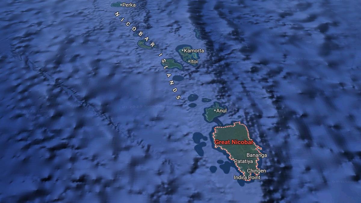
Significance of Great Nicobar’s geography:
-
- It is the largest island in the Nicobar group (910 sq. km).
- Hosts Indira Point, India’s southernmost tip, only 90 nautical miles from Sumatra, Indonesia.
- Contains two national parks and the Great Nicobar Biosphere Reserve, recognised under UNESCO’s Man and Biosphere (MAB) Programme (2013).
- Home to Shompen (a Particularly Vulnerable Tribal Group, PVTG) and Nicobarese communities.
- It is the largest island in the Nicobar group (910 sq. km).
Conclusion:
The Great Nicobar Island Project represents a convergence of strategic ambition, economic modernization, and regional integration. Its success depends on balancing national security and development goals with tribal rights and environmental stewardship—a test case for India’s sustainable development model in the Indo-Pacific.


