
Context:
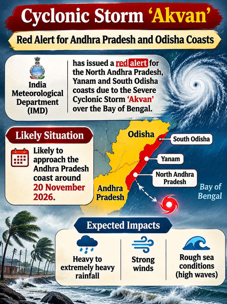
Recently, the India Meteorological Department (IMD) issued a red alert for North Andhra Pradesh, Yanam and South Odisha coasts due to Severe Cyclonic Storm 'Akvan' over the Bay of Bengal. The cyclone is likely to intensify further and approach the Andhra Pradesh coast around 20 November 2026, bringing heavy to extremely heavy rainfall, strong winds and rough sea conditions.
What is Cyclone Akvan?
Cyclone Akvan originated as a low-pressure system over the southeast Bay of Bengal and gradually intensified into a depression, deep depression and subsequently a cyclonic storm. The Bay of Bengal is particularly vulnerable to tropical cyclones due to its warm sea-surface temperatures, high moisture content and favourable atmospheric conditions. The post-monsoon period (October–December) is considered one of the most favourable periods for cyclone formation in the North Indian Ocean.
Conditions Responsible for Cyclone Formation:
Tropical cyclones generally develop over warm ocean waters with sea-surface temperatures of around 26.5°C or above. Other favourable conditions include sufficient atmospheric moisture, low vertical wind shear, a pre-existing low-pressure disturbance and adequate Coriolis force. The release of latent heat during condensation provides energy for cyclone intensification, while the Coriolis force facilitates the rotational movement of winds.
Cyclone Naming Mechanism:
The naming of tropical cyclones in the North Indian Ocean is coordinated by the WMO/ESCAP Panel on Tropical Cyclones, consisting of 13 member countries, including India, Bangladesh, Iran, Pakistan, Oman and Sri Lanka. Naming helps improve public awareness, communication, early warnings and international coordination. Cyclones over the Bay of Bengal and Arabian Sea are named by RSMC New Delhi.
Classification of Tropical Cyclones:
According to IMD classification, a depression has wind speeds of 31–49 kmph, while a deep depression has speeds of 50–61 kmph. A cyclonic storm has wind speeds of 62–88 kmph, a severe cyclonic storm 89–117 kmph and a very severe cyclonic storm 118–166 kmph. Extremely severe cyclonic storms have wind speeds of 167–221 kmph, while super cyclonic storms have wind speeds of 222 kmph or more.
Major Impacts:
Cyclones can cause heavy rainfall, flash floods, storm surges, coastal erosion and damage to agricultural crops. Strong winds may destroy houses, electricity infrastructure and communication networks. Fishing communities, coastal industries and vulnerable populations are particularly affected. Saltwater intrusion can also contaminate freshwater resources and damage agricultural land.
Government Initiatives:
-
-
- India has strengthened its disaster management framework through the National Cyclone Risk Mitigation Project (NCRMP), which focuses on cyclone shelters, early warning systems and resilient infrastructure.
- The National Disaster Management Authority (NDMA) provides disaster management guidelines, while the National Disaster Response Force (NDRF) undertakes rescue and relief operations.
- The IMD provides cyclone forecasts and colour-coded warnings. Coastal ecosystem conservation, including mangrove protection, is also promoted to reduce disaster vulnerability.
-
Conclusion:
Cyclone Akvan highlights India's vulnerability to tropical cyclones and the importance of effective disaster preparedness. India needs to move from a reactive approach towards anticipatory, technology-driven and ecosystem-based disaster management. Strengthening early warning systems, resilient infrastructure and community participation will be crucial for achieving disaster resilience in line with the Sendai Framework for Disaster Risk Reduction.