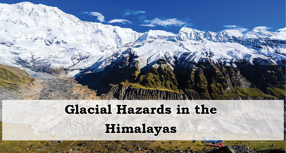
Context
On July 8, 2025, a devastating Glacial Lake Outburst Flood (GLOF) occurred in Nepal, triggered by the bursting of a supra-glacial lake in Tibet. The resulting flash flood surged through the Lende River, which flows from Tibet into Nepal, washing away a China-built friendship bridge near the Rasuwagadhi inland container port. This port, vital to Nepal's trade infrastructure, was significantly disrupted. Additionally, four hydro-power plants on the Bhote Koshi River were rendered inoperative, wiping out about 8% of Nepal’s electricity supply.
- This event wasn’t isolated. Later that same day, another GLOF occurred in the Mustang district in northern Nepal. Just two months earlier, similar events were reported in Humla district, and in 2024, a GLOF in Solukhumbu district destroyed Thame village, a key base for Everest climbers. These frequent and intense events underline the increasing threat posed by glacial lake outbursts across the Himalayan region.
Understanding GLOFs and Glacial Lakes:
A Glacial Lake Outburst Flood (GLOF) is a sudden, catastrophic release of water from a glacial lake. These lakes are formed when meltwater from glaciers accumulates in natural basins, often dammed by moraine (unconsolidated debris) or ice.
Main Characteristics of GLOFs
- Sudden and sometimes cyclic water releases.
- Rapid onset: usually lasts for a few hours to a couple of days.
- Leads to intense downstream flooding.
Types of Glacial Lakes (based on formation)
1. Moraine-dammed (most common and high-risk)
2. Ice-dammed
3. Erosion lakes
4. Other categories
These include lakes formed under various conditions, such as supraglacial lakes (on the surface of a glacier), proglacial lakes (in front of a glacier), and subglacial lakes (beneath a glacier).
In addition to these, there are some specific types of glacial lakes, such as:
-
- Cirque Lakes: These are crescent-shaped lakes that form in bowl-shaped depressions carved by glaciers.
- Paternoster Lakes: These are a series of small lakes arranged in a chain, forming one after another along a glacial valley.
- Fjord Lakes: These are narrow, deep lakes formed in glacial valleys that extend into the sea.
- Kettle Lakes: These lakes form in depressions left behind by the melting of large blocks of ice.
- Cirque Lakes: These are crescent-shaped lakes that form in bowl-shaped depressions carved by glaciers.
Triggers of GLOFs:
- Glacial surging: rapid glacier movement.
- Moraine dam instability due to loose debris or melting ice cores.
- Ice dam failure due to thermal stress or water pressure.
- Seismic activity in tectonically active zones.
- Human activity such as unplanned construction, deforestation, mining, and hydropower projects.
Historic and Recent Examples of GLOFs:
- 2023: GLOF at South Lhonak Lake, Sikkim, destroyed the Teesta III dam at Chungthang, worth $2 billion with 1,250 MW capacity. Downstream silting raised the Teesta riverbed, reducing its capacity and increasing flood risk.
- 2013: GLOF in Chorabari lake in Uttarakhand combined with a cloudburst to cause the Kedarnath catastrophe, resulting in hundreds of casualties.
- 1981: GLOF from Cirenma Co in Tibet raised the Bhote Koshi River level by 30 metres.
- 1985: GLOF from Digi Tsho.
- 1998: GLOF from Tama Pokhari.

GLOF Risks in the Indian Himalayan Region (IHR):
India’s Himalayan region is increasingly vulnerable due to climate change, inaccessible terrain, and the absence of monitoring infrastructure.
Key Facts:
- The IHR includes 11 major river basins and about 28,000 glacial lakes.
- Over 7,500 lakes are in India, mostly located above 4,500 metres — difficult to access and monitor.
- Only satellite imagery (remote sensing) is available to track changes in lake size, which is post-facto and not predictive.
Types of Lakes Found in the IHR
1. Supraglacial lakes: formed on glaciers and highly prone to melting in summer.
2. Moraine-dammed lakes: formed at glacier snouts, dammed by unstable debris — highly susceptible to sudden failures.
Evidence of Growing Risk
A 2024 report by the Central Water Commission (CWC) found a 33.7% increase in the surface area of glacial lakes in India between 2011 and 2024. When including transboundary regions like Bhutan, Nepal, and China, the total increase was 10.81%.
- 67 glacial lakes in India showed more than 40% increase in surface area, placing them in the high-risk category.
- Major expansions were observed in:
- Ladakh
- Himachal Pradesh
- Uttarakhand
- Sikkim
- Arunachal Pradesh
This alarming growth is attributed to rising global temperatures—2023 and 2024 were the hottest years recorded, leading to more meltwater accumulation and increasing GLOF risks.
Challenges in Managing GLOFs:
- Terrain inaccessibility limits field surveys.
- Short operational window in summers due to snow and altitude.
- Almost no weather or water monitoring stations in glacial regions.
- Lack of early warning systems (EWS) and poor inter-governmental communication.
- Climate vulnerability: the Himalayas lie in Seismic Zones IV & V, increasing risks of earthquake-triggered GLOFs.
- Transboundary gaps: For instance, Nepalese officials have pointed out the absence of an alert system with China, despite upstream GLOFs affecting Nepal directly.
India’s Response and Mitigation Strategy:
India, through its National Disaster Management Authority (NDMA), has shifted focus from post-disaster response to proactive risk reduction.
Key Initiatives:
- Launch of a $20 million national programme targeting 195 high-risk glacial lakes, up from an initial list of 56.
- Five-fold strategy:
1. Hazard assessment of at-risk lakes.
2. Installation of AWWS (Automated Weather and Water Stations).
3. Deployment of EWS (Early Warning Systems) downstream.
4. Risk mitigation by water drawdown or building flow-through structures.
5. Community engagement for awareness and local participation.
Technological Innovations:
- Use of Synthetic Aperture Radar (SAR) interferometry for detecting slope instabilities (up to a centimetre precision).
- Electrical Resistivity Tomography (ERT) to locate ice cores under moraine dams.
- UAVs for aerial surveys and slope mapping.
- Real-time monitoring systems in Sikkim, sending updates every 10 minutes including images and water/weather data.
Field Expedition Insights
In 2024, multiple expeditions were launched in Jammu & Kashmir, Ladakh, Himachal Pradesh, Uttarakhand, Sikkim, and Arunachal Pradesh.
- Successful use of bathymetry to measure water volume.
- Integration of community cooperation was essential—some teams adapted to local customs (e.g., not disturbing sacred lakes) and used local knowledge for navigation.
- Manual early warning roles assigned to ITBP forces in the absence of automated systems.
National and Global Frameworks
India’s Policies
- NDMA's GLOF Management Guidelines under implementation.
- Mandatory GLOF risk studies for new dams with upstream glacial lakes.
- Design flood reviews for existing/under-construction dams by CWC.
- Status mapping of glacial lakes under National Mission on Himalayan Studies (NMHS) by NIH, Roorkee.
Global Collaborations
- ICIMOD's HKH Cryosphere Initiative: regional glacial lake monitoring.
- Global Climate Observing System: supports EWS development via remote sensing.
- UNESCO: focuses on sustainable development and tourism in fragile mountain ecosystems.
- Sendai Framework: promotes cross-border disaster risk cooperation.
Conclusion
The frequency and intensity of GLOFs are escalating across the Himalayas due to rapid glacial melt, terrain instability, and weak natural dams. Countries like India and Nepal are increasingly vulnerable, with significant threats to life, infrastructure, and ecosystems.
| Main question: With reference to Glacial Lake Outburst Floods (GLOFs), critically examine the institutional, technological, and transboundary challenges in early warning and risk reduction in the Indian Himalayan Region. |


