Bhitarkanika and Brahmani
CONTEXT:
Environmentalists, recently, expressed concern over the massive diversion of fresh water from the Brahmani river basin, which could pose a grave threat to the famous mangrove vegetation, Bhitarkanika, in Odisha.
IMPORTANT POINTERS:
Bhitarkanika Mangroves Conservation Area
- Bhitarkanika — a notified Ramsar wetland — is spread over 195 sq. km and is home to 62 mangrove species. Besides, 1,600 salt water crocodiles crawl on the mudflats of the Bhitarkanika mangrove forest.
- Bhitarkanika is a unique habitat of Mangrove Forests criss-crossed with numerous creeks and mud flats located in Kendrapara district of Orissa.
- It is one of the largest Mangrove Eco systems in India,Bhitarkanika is home to diverse flora and fauna.
- The Bhitarkanika mangrove conservation area comprises of Bhitarkanika National Park and Wildlife Sanctuary and Gahirmatha Marine Sanctuary approximating around 3000 km2 area of which around 4.8% (145 km2 ) area has mangrove cover.
- Mangroves grow in brackish water. Proportionate fresh water flow from the Brahmani river basin and the Kharasrota river keep the salinity level of the water along the shore down. The brackish water becomes ideal for the mangroves to grow and stay healthy.
- The Bhitarkanika National Park, famous for the endangered saltwater crocodiles, has seen an increase of the rare species to 1,671, an annual census conducted by the Forest Department this year has found.
- The enumerators also sighted around 12 albino crocodiles and four giant crocodiles more than 20 feet long in the water bodies of Bhitarkanika during the census.
- In the Bhitarkanika area 1,580 and outside it 91 crocodiles were identified. In the Kanika 1,284, Rajnagar 296, Mahakalapada 69, Gahirmatha 22 were spotted.
- The peak winter is the ideal time to carry out the census as it exposes more than 50% of mud banks.
- Bhitarkanika National Park is located in northeast Kendrapara district in Odisha.
- It obtained the status of a Ramsar site in 2002.
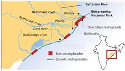
- It is surrounded by Bhitarkanika Wildlife Sanctuary. Gahirmatha Beach and Marine Sanctuary is to the east, separating swamp region and mangroves from the Bay of Bengal.
- The national park and wildlife sanctuary is inundated by the rivers Brahmani, Baitarani, Dhamra, Pathsala.
- It hosts many mangrove species, and is the second largest mangrove ecosystem in India.
- The national park is home to saltwater crocodile, Indian python, king cobra, black ibis, darters and many other species of flora and fauna.
- This huge area of mangrove forests and wetlands is intersected by a network of creeks with Bay of Bengal on the East.
- The park is famous for its green mangroves, migratory birds, turtles, estuarine crocodiles and countless creeks.
- It is said to house 70% of the country’s estuarine or saltwater crocodiles, conservation of which was started way back in 1975.
- In 1999 when coastal Odisha was battered by Super Cyclone, the rich mangrove forests had then acted as a bio-shield.
- There was very little impact of the cyclone in the mangrove-forested regions.
Brahmani River Basin
- The Brahmani river comes into existence by the confluence of the Koel and the Sankh rivers near Rourkela. It has a total length of 800 km.
- The basin is bounded in the North by Chhotanagpur plateau, in the West and South by the Mahanadi basin and in the East by the Bay of Bengal.
- The basin flows through Jharkhand, Chhattisgarh and Orissa States and drains into Bay of Bengal.
- The Basin drains into the Bay of Bengal
Sources
- Indiawris.gov.in
- The Hindu
- The Indian Express
- Orissa wildlife website


