Daily-current-affairs /
09 Oct 2020
Property Cards Under SVAMITVA Scheme: Daily Current Affairs for UPSC, IAS, UPPSC/UPPCS, BPSC, MPPSC, RPSC & All State PCS Examinations
Property Cards Under SVAMITVA Scheme
IN NEWS
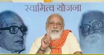
- Prime Minister Narendra Modi will launch the physical distribution of property cards under the
SVAMITVA (Survey of Villages and Mapping with Improvised Technology in Village Areas)
scheme.
ABOUT
- The property cards being rolled out under the SVAMITVA scheme launched by the Prime
Minister in April are physical copies of property titles of the villagers’ homes and the surrounding
areas they own (as opposed to the cultivated land), which will be handed over to around 132,000
landowners during the event.
- The SVAMITVA scheme will cover 662,000 villages in a phased manner over a period of four
years and the move will pave the way for using property as a financial asset by villagers for
taking loans and other financial benefits
SVAMITVA SCHEME
- SVAMITVA Scheme is a Central Sector scheme launched by Hon’ble Prime Minister of India on
National Panchayat Day i.e 24th April 2020.
- The Ministry of Panchayati Raj (MoPR) is the Nodal Ministry for implementation of the scheme.
- In the States, the Revenue Department / Land Records Department will be the Nodal Department
and shall carry out the scheme with support of State Panchayati Raj Department. Survey of India
shall work as the technology partner for implementation.
- The scheme aims to provide an integrated property validation solution for rural India. The
demarcation of rural population areas would be done using Drone Surveying technology.
- This would provide the ‘record of rights’ to village household owners possessing houses in
inhabited rural areas in villages which, in turn, would enable them to use their property as a
financial asset for taking loans and other financial benefits from Bank
The scheme seeks to achieve the following objectives: -
- To bring financial stability to the citizens in rural India .
- Creation of accurate land records for rural planning.
- Determination of property tax,
- Creation of survey infrastructure and GIS maps that can be leveraged by any department for their
use.
- To support in preparation of better-quality Gram Panchayat Development Plan (GPDP) by
making use of GIS maps.
- To reduce property related disputes and legal cases